Alternative Satpy scripts
Some alternative scripts are described here.
The differences with the original (v4.1) scripts are:
- One script for each satellite type, e.g. one for MSG2,3,4; one for Metop-B,C etc.
- Mandated options for Date and (for LEO's) day/night pass have -t and -dn options
- Other options for area, composite, source location, destination location,output filename etc.
Also, some simple gui's are available. The whole set is now combined into one zip-file.
Differences with original scripts
All scripts of one type of satellite are replaced by one script; all
area/composte/overlay combinations are possible by means of commandline options.
E.g.:
MSG2-afghanistan.py, MSG3-isomrss.py, MSG4-msg_fes_rss.py etc. are replaced by MSG.py.
GEO scripts
These are:
- main scripts:
- MSG.py
- MTI.py
- HIMA.py
- GOES.py
- Lower level scripts:
- GEOstuff.py (basically the same as the orignal one, but also supports out-of-service satellites)
- GEO_extrastuff.py (for extra features like option handling and a simple viewer)
LEO scripts
These are:
- main scripts:
- Metop.py
- NOAA.py
- AquaTerra.py
- FY3D.py
- Sen3.py
- Lower level scripts:
- LEOstuff.py (basically the same as the orignal one, but also supports out-of-service satellites and historical tle nadling)
- LEO_extrastuff.py (for extra features like option handling and a simple viewer)
GUI scripts
- main scripts:
- satpy_areavis.py: show selectable area of all defined area's
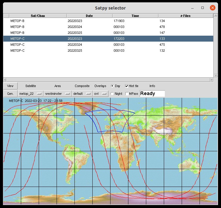
- satpy_selector.py: a selector to generate/show images of any satellite type at any area, composite and ovelays
- Lower level scripts:
- satpy_settings.py: to configure the selector
- satpy_plottrack.py
- satpy_areas.py
- earthmap.gif
Installation (5-5-2024)
First install the original SPS environment as usual.
Download eSPStools.zip and unzip it besides SPStools
Add extra Python libraries:
- conda activate pytroll
- conda install logbook
- conda install represent
- conda install rush
- conda install spacetrack
If the last 2 gives problems (error wrong python version) then you can use the ones present in eSPStools:
- cd eSPStools
- unzip rush.zip
- unzip spacetrack.zip
It's not nice to do it this way but at least, that works for me.
Now you are in eSPStools you can try the executables:
python satpy_areavis.py (or in Linux just ./satpy_areavis.py)
That should give you the folowing window:
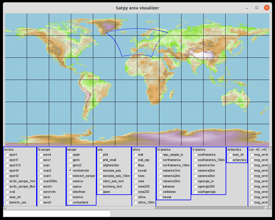
Here you can select and show all available areas.
Further adaptions
SPS settings
In GEOstuff.py and LEOstuff.py in eSPStools, adapt:
The same way as you probably already did in the original GEOstuff.py and LEOstuff.py.
This is enough for using the alternative MSG.py etc. scripts.
For satpy_selector
In satpy_settings.py:
- exe_cmd:
- python <path> or
- python3 <path>
- <path>=path where all scripts to execute are (MSG.py, Metop.py etc.); if you start satpy_selector from here just: ./
- data_loc:
- in the third column the path to the locations of received/downloaded files
you may remove lines and/or add extra lines:
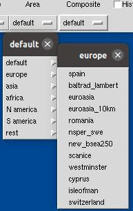
- first column: sat-ID, always the same for a certain satellite (this name is linked to the 'composite_list')
- second column: a name you may choose, this will pop-up in the menu of satpy_selector
Run satpy_selector
This will give you:
for geo-sats:
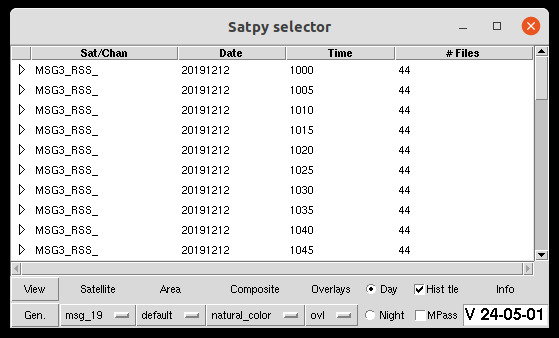
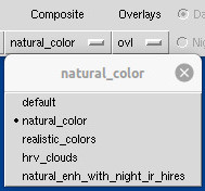
From the bottom menu, select satellite and:
Configuration of All menu's is defined in satpy_settings.py.
Now click on:
View to get directly an image
Gen to generate an image file
For polar-sats the window shows like this: